
Images released by the United Nations Institute of Training and Research show the extent of the damage done by Israel’s military campaign to parts of the Gaza Strip
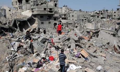
The United Nations Institute of Training and Research has released before and after images of parts of the Gaza Strip, highlighting the extent of the destruction.
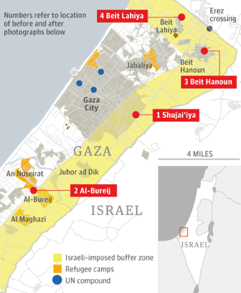
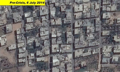
An image of the area of Shujai’iya on 6 July, before the start of Israeli air strikes.
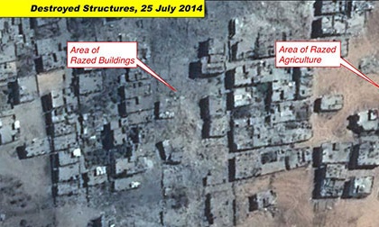
The same area 19 days later, during the strikes, with blocks of buildings razed to the ground.
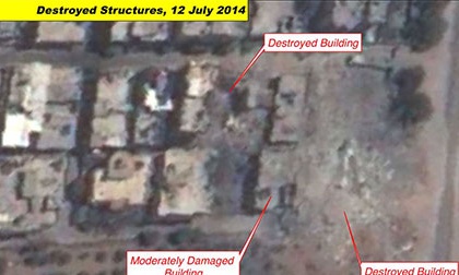
A satellite photograph of al-Bureij, a Palestinian refugee camp, on July 6th.
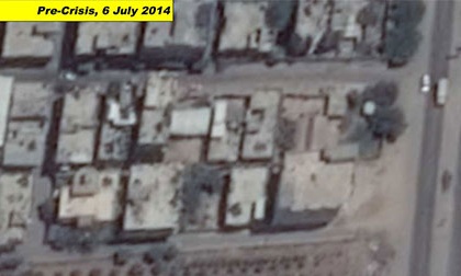
A picture taken on 12 July, 4 days after the launch of the Israeli military operation shows a series of destroyed buildings.
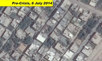
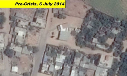
A pre-crisis photograph from 6 July showing Beit Hanoun, a city on the north-east edge of the Gaza Strip.
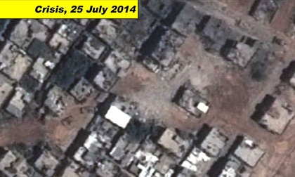
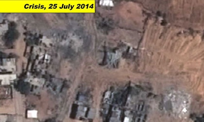
A shot of the same area on 25 July shows that many of the buildings have been destroyed.
An area of the city of Beit Lahiya before the crisis.
The same area 19 days later.
No comments:
Post a Comment